“maps” search results (882)
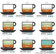
Coffee common sense commonly used coffee production scale map
Collect a proportion of coffee map feel good, share it.
2014-11-08 coffee knowledge coffee making scale map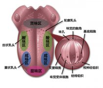
Taste map, drink coffee, taste coffee.
With regard to taste maps, coffee and red wine are often used in tasting. Taste refers to the ability to sense the taste of substances, including the taste of food, certain minerals and toxic substances, which is close to the sense of smell, which is also chemically induced. Western experts have traditionally believed that taste consists of four basic flavors: sweet, salty, sour and bitter.
2015-03-14 Taste coffee taste feeling about red wine tasting inside
About Coffee World Map
COFFEE WORLD MAP Most coffee production areas are located between the Tropic of Cancer, that is, 25 degrees north of the equator and 30 degrees south of the equator in the tropics or subtropics. Areas with an annual average temperature of 16-25 degrees Celsius, frost-free and rainfall of 1600-2000 mm. At present, there are more than 70 major coffee producing countries, and the Greater China is located at an altitude of 300-400 meters.
2014-09-10 Coffee belt coffee knowledge coffee encyclopedia coffee beans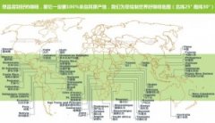
Types of boutique coffee beans world-famous boutique coffee beans and their producing area distribution map
World Fine Coffee Map Latin American Coffee beans (Central and South America) Brazil: Santos, Bahia, Cerrado, Mogiana Mexico: Coatepec, Huatusco, Orizaba, Maragogype, Tapanchula, H
2014-09-18 Types of boutique coffee beans single boutique coffee beans origin of coffee beans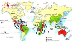
Map of Global Coffee producing areas
1. Costa Rica Costa Rica 2. Cuba Cuba 3. Dominican Republic Dominican Republic 4. Ei Salvador El Salvador 5. Guadeloupe Guadeloupe 6. Guatemala Guatemala 7. Haiti Haiti 8. Honduras Honduras 9. Jamaica Jamaica 10. Martinique Martinique 11. Mexico Mosi
2014-07-09 Coffee producing area coffee producing area map coffee planting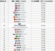
Coffee consumption map
This is a list of the top 20 countries that consume coffee per capita each year. The figure is 2008 or earlier. Global production is 7358897 tons, so the world averages 1.3kg per person per year.
2014-08-30 Coffee consumption map
The World Map of Fine Coffee beans-Asia
1. China (coffee production in China is mainly in Yunnan, Hainan and Taiwan. At present, Yunnan Province accounts for 70% of the country's coffee planting area and 83% of the country's output. Yunnan coffee has established its dominant position in China in terms of both planting area and coffee bean production.) 2. India 3, Indonesia 4, Yemen 5, Vietnam (responsibility
2014-09-02 Coffee knowledge coffee beans world coffee map coffee distribution in Asia
World Map of Coffee beans
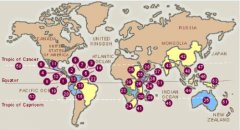
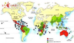
There are shadows of coffee beans in many parts of the world, and they can grow normally as long as the climate is right. These places suitable for the cultivation of coffee beans, usually located between the Tropic of Cancer and the Tropic of Cancer, are called coffee growth zones. R: Robusta coffee beans M: mixed coffee beans A: Arabica coffee beans
2014-09-05 Coffee beans coffee bean maps coffee bean producing areas

Map of global coffee producing area for the production of boutique coffee beans
Coffee trees grow in tropical or subtropical agricultural gardens centered around the equator and called coffee belts. Most of the coffee production is between the Tropic of Cancer, 25 degrees north of the tropical or subtropical equator and 30 degrees south of the equator. An area with an annual average temperature of 16-25 degrees Celsius, no Frosts Descent and rainfall of 1600-2000 mm.
2014-12-30 Boutique coffee beans production global coffee origin map tree growing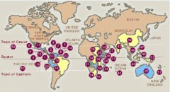
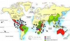
Basic knowledge of Coffee training Global Coffee producing area Map
Coffee trees grow in tropical or subtropical agricultural gardens centered around the equator and called coffee belts. Most of the coffee production is between the Tropic of Cancer, 25 degrees north of the tropical or subtropical equator and 30 degrees south of the equator. An area with an annual average temperature of 16-25 degrees Celsius, no Frosts Descent and rainfall of 1600-2000 mm.
2015-03-17 Coffee training basic knowledge Global Origin Map Tree growth Red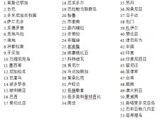
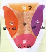
Must-read for coffee tasting-tongue taste map
The picture seen in a red wine lecture is now for everyone to actually feel. It can explain why the first taste of wine rolls in the mouth and why the coffee cup test takes a big sip. Let's understand it together. Remember: before the sweet and the bitter side of the acid-base.
2015-06-19 Coffee tasting must-read tongue taste distribution map once red wine seat see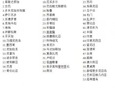
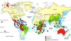
Analysis of global coffee producing area map analysis of coffee bean production area
Coffee trees grow in tropical or subtropical agricultural gardens centered around the equator and called coffee belts. Most of the coffee production is between the Tropic of Cancer, 25 degrees north of the tropical or subtropical equator and 30 degrees south of the equator. An area with an annual average temperature of 16-25 degrees Celsius, no Frosts Descent and rainfall of 1600-2000 mm.
2015-10-15 Global coffee origin map analysis coffee beans place of production tree growth growth
Coffee bean producing area map of African coffee bean producing area has characteristics of coffee
Democratic Republic of the Congo: Kivu, Ituri Rwanda: Kivu Kenya: AA, Kenya AA Oreti Estate, Uganda: Elgon, Bugisu, Ruwensori Zambia: Kasama, Nakonde,
2016-04-20 Coffee beans origin Africa producing areas maps characteristics coffee Congo democracy republic
Global coffee producing area map coffee bean producing area
1. Costa Rica Costa Rica 2. Cuba Cuba 3. Dominican Republic Dominican Republic 4. Ei Salvador El Salvador 5. Guadeloupe Guadeloupe 6. Guatemala Guatemala 7. Haiti Haiti 8. Honduras Honduras 9. Jamaica Jamaica 10. Martinique Martinique 11. Mexico Mosi
2015-02-15 Global Coffee Origin Map Coffee beans producing areas Costa Rica